Aansluitingen GMF
Tim Vrijsen

Curious how it works?

Tim Vrijsen (portret)

Find out how GO Mapforms can speed up and improve your connection process. Download our whitepaper now. If you have any questions you can also contact Tim Vrijsen directly.

Whitepaper

GO MapForms

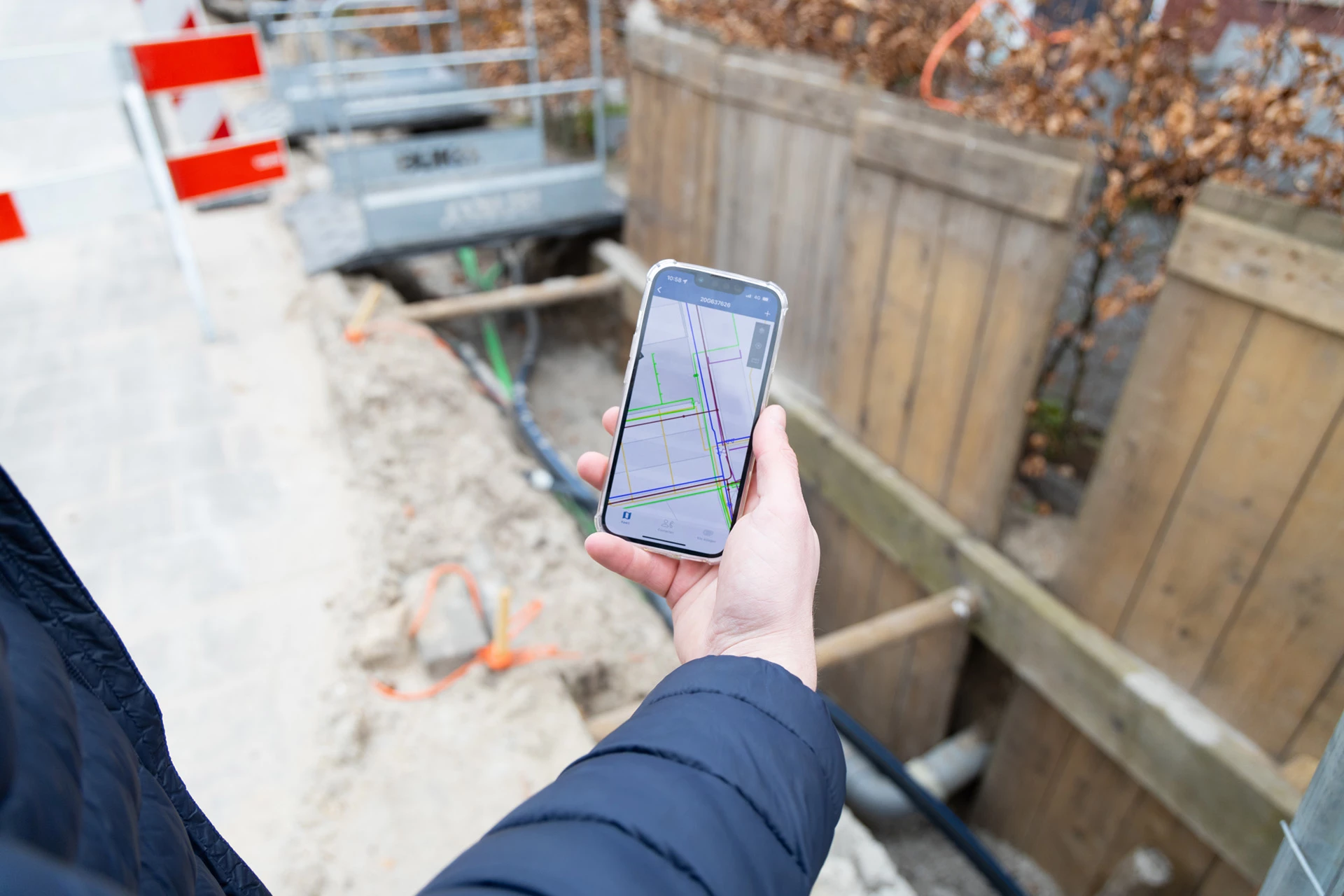
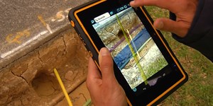
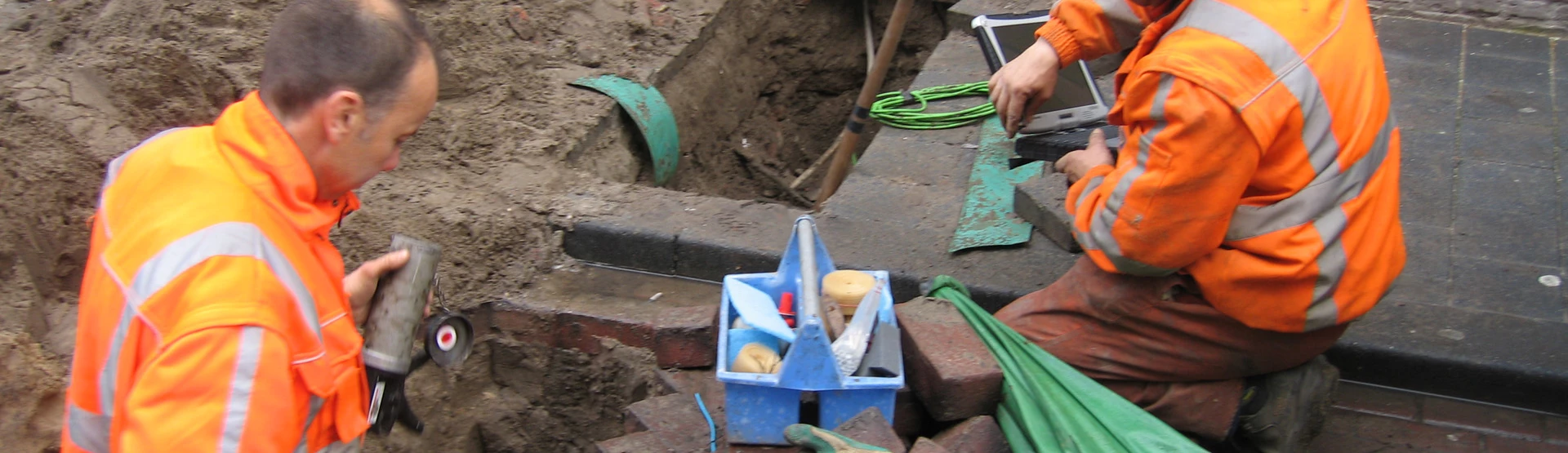
GO MapForms is a proven solution for an efficient and simplified connection process. The innovative technology makes it possible to deliver revision data, documents and photos within 24 hours after making the overhaul of assets in the ground. 

Software for contractors and network operators

GOconnectIT knows the working method of contractors and network operators like no other. With our technology, digitization and automation of the connection process in the field, is possible. This increases quality and speed, and ensures that clients meet requirements of network operators. Meanwhile, our solutions provide an accelerated and uniform process for all contractors and various large network operators. This makes GO MapForms the first fully operational tool for collecting as-built information without using complex surveying equipment.

What is the proven process of GO MapForms?

  1. New order
  2. Preparation
  3. Inspection
  4. Execution
  5. Approval
  6. Delivery

GO MapForms is usefull for public lighting, gas, water, electricity and telecoms. Thanks to the software, you can obtain coordinates without surveying equipment. It helps with the verification of sketches in the field. The solution works on the 'first time right' principle.

In addition, you can export advanced Excel reports. Finally, you have a representation of actual location and the software is specially made for the infrastructure technician.

Benefits

  • Fully digital documentation

  • Shorter lead time

  • Increased quality of delivered data

  • No expensive license, pay per use

  • Uniform method and output in required format

  • Proven solution: more than 1.000.000 sketches made

  • Complete SaaS web portal with apps (Android, iOs)

Products and services

Other products and services

GOconnectIT also offers useful other tools

In addition to working in our clients' GIS systems, we can also deploy our own ATLAS GIS system to manage cable and pipeline networks for network operators and project organisations. ATLAS is based on Smallworld ™ Core Spatial Technology, a product of GE Energy that offers a powerful architecture for various applications and of which GOconnectIT is Solutions Provider.
With Lovion from our German partner ITS, we offer comprehensive IT support for technical business processes. Thanks to its deep integration with GIS and ERP systems, Lovion makes information such as maps, asset data and process data quickly and easily available to employees. Discover what GOconnectIT can do for you in the field of GIS systems and consultancy.
Coordination of the entire process of cables and pipelines. Our experienced project managers can take care of all your problems during relocation projects or provide legal advice on cables and pipelines.
Legal frameworks are necessary for a good structure in the subsurface. The conditioning of cables and pipes has various, complex legal components. And that is exactly what we have been doing for years.
GO Academy offers short courses of one day on the theme of cables and pipes. Our trainers have years of experience and use a qualitative and result-oriented approach. The participants' field of work is always central. Knowledge and skills can be applied immediately.